

Developing a Unique Slum Atlas: Improving the Living conditions in PMC’s Informal Settlements
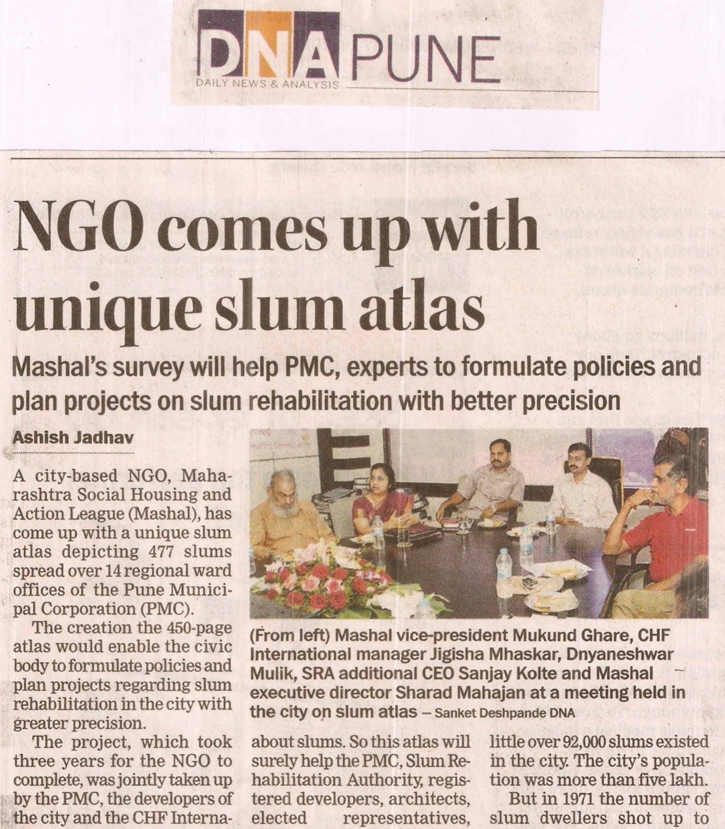
In January of 2011, we finally concluded our three-year-long 450-page slum atlas development project. This slum atlas maps 477 slums spread over 14 regional ward offices of the Pune Municipal Corporation (PMC). The atlas includes mapping of all the identified slums spread across the city and detailed information regarding the area of slum, number of houses, and population.
The slum atlas is a reliable reference document for professionals, academic institutions, social marketers, the government, bilateral funding organizations, micro-finance institutions, real estate companies, political representatives, ULB, NGOs, Slum Dwellers, and Corporate Social Responsibility (CSR) departments of various corporations.
Acknowledging Our Key Collaborators
For a project of such a large scale, we were glad to have joined with the government and social organizations. We collaborated with:
- The PMC
- The developers of the city
- CHF International (Global Communities)
The Pune Municipal Corporation (PMC) is the civic administration body responsible for Pune City and has since undertaken several large-scale slum rehabilitation and improvement projects.
The CHF International, now known as Global Communities, has been mapping urban poverty in areas of India and Africa through their program “Slum Communities Achieving Livable Environments with Urban Partners”, and working on slum upgrading, urbanization and climate change initiatives in India since 2007. They performed socioeconomic surveys within 360 of the 477 PMC slums, breaking each slum down into clusters of 25 households and gathering relevant information with the help of one volunteer from each cluster.
Data Insights and Our Observations
According to the statistical insights we derived while developing the atlas, there were a total of 1.57 lakh households in the 477 identified slum pockets, covering 2.34% of the total land in the city. Of the city’s 2011 population of 44.44 lakh, more than 17.50 lakh resided in slums. Through our surveys, we also observed that there has been a constant increase in slum population since 1951.
Before 1961, around 92K slums existed in the city, with the total city’s population being 5 lakh. However, after the Panshet dam calamity, when several parts of the city were partially submerged, the number of slum households drastically increased to 2.40 lakh, out of a total population of 8.56 lakh. Our survey also stated that the maximum number of slums were under the Bhavani Peth and Dhole Patil Road regional ward offices. Hadapsar and Sangamwadi regional ward offices had 56 and 53 slum pockets respectively.
To conclude the findings, following a steady increase since 1951, particularly after the 1961 Panshet dam calamity, the city’s slum population grew to constitute 39% of the total population by 2011, with the highest concentration of 62 slum pockets in each of the Bhavani Peth and Dhole Patil Road wards.
How do Slum Atlases Help Informal Settlement Communities?
Slum atlases support vulnerable communities by providing precise demographic, housing, and infrastructure data, which enables local governments and NGOs to target welfare programs, secure basic services like water and sanitation, and design rehabilitation projects that help residents retain their livelihoods.
Key Benefits of Slum Atlases:
- Targeted Welfare Delivery: Atlases map socio-economic profiles to help municipalities identify specific target groups for state and central government initiatives and housing schemes.
- Infrastructure Upgrades: By mapping core Water, Sanitation, and Hygiene (WASH) indicators set by WHO and UNICEF, atlases highlight last-mile gaps, which drives city governments to integrate slum infrastructure into formal municipal networks.
- Livelihood Protection: By observing slum boundaries and official city development plans, planners can plan in-situ redevelopment. Geospatial data and satellite imaging help estimate relocation distances, so residents don’t lose their livelihoods during transitions.
How we at MASHAL make use of Slum Atlases
For over 40 years, utilizing the data from our Surveys and GIS Mapping initiatives, we have been working across Housing and Habitat, Community Development, Education, Disaster Risk Reduction and Response, and Research and Advocacy. To this date, we have mapped over 10 lakh slum dwellers.
We have been integrating mapping technology with community voices to derive data that reflects how people truly live. We believe that data collection must always be participatory, community-informed, and grounded in the realities of the people it represents.
Our surveys and mapping generate accurate, community-level information that supports urban planning, service delivery, and policy decisions for vulnerable communities. We have been focused on participatory rehabilitation, affordable housing, resilient construction, in-situ slum redevelopment, post-disaster reconstruction and community-centered planning.
What Comes Next?
The mapping and survey of the slum pockets in Pune were conducted till 2011. In recent years, we have been implementing Drone Technology and revisiting all the slums to ascertain changes. As we look ahead, we aim to continue supporting low-income communities through technical assistance, housing planning, infrastructure strengthening, and community participation.
Every family deserves a safe roof and a healthy living environment, and the first step to achieving this is gathering accurate data. Partner with us to transform informal settlements into dignified communities. Support MASHAL’s Housing Initiatives Today.